


الاخبار


اخبار الساحة الاسلامية

أخبار العتبة العلوية المقدسة
أخبار العتبة الحسينية المقدسة
أخبار العتبة الكاظمية المقدسة
أخبار العتبة العسكرية المقدسة
أخبار العتبة العباسية المقدسة
أخبار العلوم و التكنولوجيا
الاخبار الصحية
الاخبار الاقتصادية

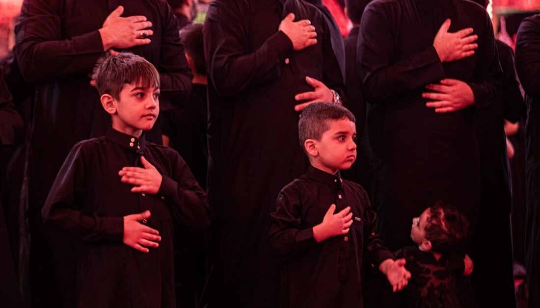
صغار كربلاء.. عزاء بحجم الحلم وقلوب تنبض بالحسين (ع)
 المصدر:
imamhussain.org
المصدر:
imamhussain.org
 11:52 صباحاً
 2025-06-30
 51
51


أطفال بين صفوف العزاء.. مشهد لا يشبه سواه
في كل صباح من أيام العشرة الأولى من محرم الحرام، وبينما تتقاطر مواكب العزاء إلى الصحن الحسيني الشريف، يلوح في الأفق مشهد يأسر القلوب قبل العيون، حيث أطفال في عمر الزهور، يرتدون السواد، ويحملون الرايات، ويرددون الهتافات، ويمضون بخطى ثابتة خلف المواكب، هؤلاء الصغار، لا يشاركون مجرد مشاركة رمزية، بل يظهرون بإحساس حقيقي، وكأن دموعهم تربت في حضن كربلاء.
“أريد أمشي مثل أبي، أريد أكون مع تلك السواعد اللي تلطم”، يقول علي ذو الثمان سنوات، وهو يمسك براية صغيرة، يلوح بها في مقدمة احد المواكب، بينما تؤكد والدته "كل سنة ينتظر محرم بفارغ الصبر، لا يطلب ملابس جديدة، بل يسأل عن موعد نزول الموكب".
خطة العتبة الحسينية.. تنظيم شامل لتأمين الشعائر والمشاركين
لم يكن هذا المشهد الإنساني مؤثرا فقط، بل جاء ضمن خطة تنظيمية متكاملة أعلنتها العتبة الحسينية المقدسة لاستقبال مواكب العزاء خلال العشرة الأولى من شهر محرم الحرام، حيث يقول مسؤول قسم الشعائر والمواكب في العتبة المهندس رسول فضالة "نحن أمام مشهد يومي يتطلب دقة في التنظيم"، لافتا إلى أن "دخول المواكب يبدأ من الصباح وحتى ما بعد منتصف الليل، وتم تخصيص مسارات محددة ومواعيد دقيقة لضمان الانسيابية، وخاصة مع مشاركة الأطفال الذين يحتاجون إلى بيئة آمنة ومنظمة".
ويوضح أن "الخطة دخلت حيز التنفيذ منذ اليوم الأول من محرم الحرام، بعد إصدار الكفالات الرسمية لمواكب الأطراف والهيئات"، مشيرا إلى أن "هذه الفترة مخصصة لمواكب أهالي كربلاء حصرا، بخلاف زيارة الأربعين".
مواكب الصباح والمساء.. انسيابية مدروسة في حركة العزاء
ويتابع أن "المواكب تبدأ بالدخول صباحا بمواكب الزنجيل، تليها مساء مواكب الردات والأطراف بعد صلاتي المغرب والعشاء، مع تهيئة أربعة منابر رئيسة هي منبر باب السدرة، ومنبر الرجاء، ومنبر الكرامة، ومنبر باب الزينبية، وجميعها مزودة بمنظومات صوتية حديثة وممرات منظمة للدخول والخروج".
كما نشرت مفارز للدفاع المدني لتقديم التوعية، وتنسيق مباشر مع الأجهزة الأمنية، لتأمين سلاسة الشعائر وحماية المشاركين، خاصة من الفئات الأصغر سنا.
أطفال يحسدون رموز الطف.. من الوجدان إلى الموكب
في قلب العزاء، لا تقتصر مشاركة الأطفال على المشي في الصفوف، بل يحمل بعضهم رموز الطف، فذاك يجسد "علي الأصغر (عليه السلام)"، وآخر يرتدي زي القاسم (عليه السلام)، وغيرهم يرفعون رايات كتب عليها "يا حسين" أو "لبيك يا عباس".
حسن، ذو الأحد عشر عاما، يشارك في موكب جده للسنة الثالثة، وتقول والدته "هو من يصر على المشاركة، ونحن فقط نهيئ له الزي، أما القرار فهو قراره".
رسالة تربوية وإنسانية تتوارثها الأجيال
مشاركة الأطفال في العزاء ليست طقسا فحسب، بل تربية وجدانية وروحية تتغلغل في وجدانهم منذ الصغر.
يقول أحد الخطباء في ساحة باب الزينبية، "حين يهتف طفل بالحسين (عليه السلام)، فهو لا يردد شعارا، بل يعلن انتماءه المبكر لقضية كبرى".
ويلفت إلى أن "الشعائر قضية وجدانية متغلغلة بالجذور نتوارثها اجيالا بعد اجيال لذا تجد أطفالنا متعلقين بها وينتظروها بفارغ الصبر".
خدمة الزائرين أولوية دائمة للعتبة الحسينية
تواصل العتبة الحسينية المقدسة، وبتوجيه مباشر من ممثل المرجعية الدينية العليا الشيخ عبد المهدي الكربلائي، تنفيذ خطط متكاملة لخدمة الزائرين على كل المستويات (الصحية، والأمنية، والتنظيمية، والخدمية)، واضعة الملف الصحي والإنساني والتنظيمي في صدارة أولوياتها، لتأمين زيارة آمنة وكريمة لملايين القادمين.
كربلاء تعلم الطفولة أن تكون راشدة
وفي كل صباح من عاشوراء، يتكرر المشهد، أطفال يطرقون أبواب الحسين (عليه السلام) بلا لغة، فقط بالدمعة، بالراية، بالهتاف، وبالحب، فكربلاء لا تنتظر أن يكبروا ليشاركوا، بل تعلمهم أن العزاء ليس للعمر بل للقلب.
اخبار ذات صلة
 (نوافذ).. إصدار أدبي يوثق القصص الفائزة في مسابقة الإمام العسكري (عليه السلام)
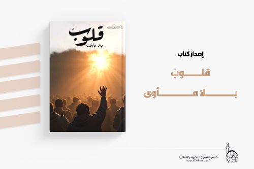 قسم الشؤون الفكرية يصدر مجموعة قصصية بعنوان (قلوب بلا مأوى)
 قسم الشؤون الفكرية يصدر مجموعة قصصية بعنوان (قلوب بلا مأوى)